Playback starts YouTube’s embedded player (privacy-enhanced mode).
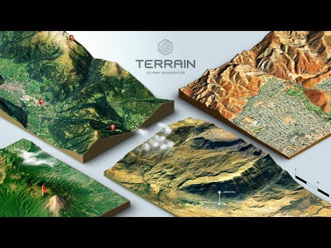
How to create a 3D Terrain with Google Maps and height maps in Photoshop - 3D Map Generator Terrain
ChannelOrange Box CeoIn brief
Turn a real-world location into a 3D terrain model in Photoshop using Google Maps satellite imagery and height maps. This quick method works without specialized 3D software and is ideal for designers or hobbyists who want to visualize landscapes.
Questions & answers
Do I need a 3D program for this?
No—Photoshop and Google Maps are the only tools required.
Why isn’t the 3D effect working?
Ensure you’re using a 2D satellite map URL, not the 3D globe view.
Chapters
Description from the creator
More info: 3d-map-generator.com/3d-map-generator-terrain/
This video shows you how to make a 3D map of almost any location in the world in less than 10 minutes. And you don't even need any 3D program for it - just Photoshop, Google Maps and the 3D Map Generator terrain.
0:00 - example map Lienz ( commented )
7:06 - example map Le Leona
11:58 - example map Simi Valley
15:42 - example map Temphe
Important: Copy the map view URL, not the satelite URL!
__
Note: Google Maps has changed the "3D off" feature. Now turn off globe, above the traffic setting to get a 2D satellite map (texture).
---
Note: All suggested heightmap services are not part of the 3D Map Generator – Terrain. They are just options for getting a grayscale heightmap. There is no guarantee of availability or functionality.
---
Take a Screenshot MAC:
wikihow.com/Take-a-Screenshot-With-a-Macbook
Take a Screenshot PC:
wikihow.com/Take-a-Screenshot-in-Microsoft-Wind…
This video shows you how to make a 3D map of almost any location in the world in less than 10 minutes. And you don't even need any 3D program for it - just Photoshop, Google Maps and the 3D Map Generator terrain.
0:00 - example map Lienz ( commented )
7:06 - example map Le Leona
11:58 - example map Simi Valley
15:42 - example map Temphe
Important: Copy the map view URL, not the satelite URL!
__
Note: Google Maps has changed the "3D off" feature. Now turn off globe, above the traffic setting to get a 2D satellite map (texture).
---
Note: All suggested heightmap services are not part of the 3D Map Generator – Terrain. They are just options for getting a grayscale heightmap. There is no guarantee of availability or functionality.
---
Take a Screenshot MAC:
wikihow.com/Take-a-Screenshot-With-a-Macbook
Take a Screenshot PC:
wikihow.com/Take-a-Screenshot-in-Microsoft-Wind…
About this tutorial
Orange Box Ceo published this 20:32 video tutorial on October 28, 2017. It has been watched 9,604,970 times on YouTube.
- Channel
- Orange Box Ceo
- Category
- Education
- Duration
- 20:32
- Published
- October 28, 2017
- Views
- 9,604,970
- Likes
- 27,095
Share
This tutorial in other languages
- FRComment créer un relief 3D avec Google Maps et des cartes hauteur dans Photoshop - Carte 3D Générateur relief
- ESCómo crear un terreno en 3D con Google Maps y mapas de altura en Photoshop - 3D Map Generator Terreno
- PTComo criar um terreno em 3D com o Google Maps e altura mapas em Photoshop - 3D Map Generator Terrain
- ITCome creare un terreno 3D con Google Maps e l'altezza mappe in Photoshop - 3D Map Generator Terrain
- DE3D Map Generator Terrain - wie ein 3D-Terrain mit Google Maps und Höhenkarten in Photoshop erstellen
- NLHoe maak je een 3D-terrein met Google Maps te creëren en hoogte kaarten in Photoshop - 3D-kaart Generator Terrain
- RUКак создать 3D местности с сайта Google Maps и высота карты в Photoshop - 3D Map Generator Terrain
- PLJak stworzyć 3D terenu z Google Maps i wysokość mapy w programie Photoshop - 3D Map Generator Terrain
- JA3Dマップジェネレータ地形 - PhotoshopでGoogleマップと高さマップと3D地形を作成する方法
- ARكيفية إنشاء التضاريس 3D مع خرائط جوجل وخرائط ارتفاع في فوتوشوب - 3D خريطة مولد التضاريس
- HIकैसे गूगल मैप्स के साथ एक 3 डी मैदानी बनाने के लिए और ऊंचाई में फ़ोटोशॉप नक्शे - 3 डी मानचित्र जेनरेटर भू-भाग
- IDCara membuat Medan 3D dengan Google Maps dan tinggi peta di Photoshop - 3D Peta Generator Medan