Playback starts YouTube’s embedded player (privacy-enhanced mode).
How to Pace in Land Surveying
ChannelRami TamimiDescription from the creator
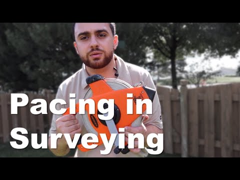
The purpose of this video is to introduce the viewers to basic distance measurement and the processes associated with the measurement process. We will be measuring distances by pacing. There are three steps in doing this.
Join The Survey School - thesurveyschool.com/
Join me on Social Media:
🖥️ Website: tamimi.biz
👥 Private Facebook Group: facebook.com/groups/iamasurveyor
📸 Instagram: instagram.com/ramitamimi
👔 LinkedIn: linkedin.com/in/ramitamimi/
✉️ Email: [email protected]
Step 1 - Pace Calibration
We have established a baseline by which you can determine (calibrate) your pace length. You calibrate you pace against a known standard (200 feet) by counting the number of paces you take between two pre-established points exactly 200 feet apart. Repeat the procedure. Record the number of paces you took each time you paced the calibrated distance.
Step 2 - Pace between points
You will pace between three different points. These point will be marked with lathes and colored ribbons. Measure the distance between each of the points by pacing a minimum of two (2) times. Typically, the distances are paced once (forward) by going clockwise and once again (reverse) counter-clockwise. If the repeat distances between any of the points differ from the initial measurements by more than two paces; repeat the measurement of that particular course.
Step 3 - Analyze the Data
Determine your calibrated pace by averaging the number of paces (add the four entries and divide by 4) you recorded on the calibration line (200 feet line) and divide the average into 200 feet. The resultant, calibrated pace. This will then be used to find the distance between the points in feet, by multiplying it by the number of paces taken between the points. Then we will calculate the accuracy by subtracting our paced distance from the actual distance to get the difference. The dividing the difference from the actual distance to get the accuracy. Ghilani Book states that experienced "pacers" can achieve an accuracy of 1/50 to 1/100 - that is +/- 1 Part of Error in 50 to 100 parts of measured distance. So - if you achieve say 1/100 – that’s very good. Conversely, if you achieve 1/50 - that's not as good.
About Professor Rami Tamimi:
Rami Tamimi is an American doctorate student at The Ohio State University working towards his Doctor of Philosophy in Geodetic Engineering. With over 8 years of experience in the Land Development Industry, his experience revolves around traditional field surveying, civil design work using AutoCAD Civil 3D, and geospatial technology including LiDAR, SONOR, and Photogrammetric data acquisition and processing with the use of Unmanned Aircraft Systems or Drones. He is also a University Professor and creates instructional video content on YouTube.
Intro: (0:00)
What is Pacing: (0:15)
Calibrating our Pace: (2:44)
Pacing between Points: (6:06)
Calculating Distance and Accuracy: (8:37)
Outro: (11:51)
#Surveying #Pacing #Calibration
Join The Survey School - thesurveyschool.com/
Join me on Social Media:
🖥️ Website: tamimi.biz
👥 Private Facebook Group: facebook.com/groups/iamasurveyor
📸 Instagram: instagram.com/ramitamimi
👔 LinkedIn: linkedin.com/in/ramitamimi/
✉️ Email: [email protected]
Step 1 - Pace Calibration
We have established a baseline by which you can determine (calibrate) your pace length. You calibrate you pace against a known standard (200 feet) by counting the number of paces you take between two pre-established points exactly 200 feet apart. Repeat the procedure. Record the number of paces you took each time you paced the calibrated distance.
Step 2 - Pace between points
You will pace between three different points. These point will be marked with lathes and colored ribbons. Measure the distance between each of the points by pacing a minimum of two (2) times. Typically, the distances are paced once (forward) by going clockwise and once again (reverse) counter-clockwise. If the repeat distances between any of the points differ from the initial measurements by more than two paces; repeat the measurement of that particular course.
Step 3 - Analyze the Data
Determine your calibrated pace by averaging the number of paces (add the four entries and divide by 4) you recorded on the calibration line (200 feet line) and divide the average into 200 feet. The resultant, calibrated pace. This will then be used to find the distance between the points in feet, by multiplying it by the number of paces taken between the points. Then we will calculate the accuracy by subtracting our paced distance from the actual distance to get the difference. The dividing the difference from the actual distance to get the accuracy. Ghilani Book states that experienced "pacers" can achieve an accuracy of 1/50 to 1/100 - that is +/- 1 Part of Error in 50 to 100 parts of measured distance. So - if you achieve say 1/100 – that’s very good. Conversely, if you achieve 1/50 - that's not as good.
About Professor Rami Tamimi:
Rami Tamimi is an American doctorate student at The Ohio State University working towards his Doctor of Philosophy in Geodetic Engineering. With over 8 years of experience in the Land Development Industry, his experience revolves around traditional field surveying, civil design work using AutoCAD Civil 3D, and geospatial technology including LiDAR, SONOR, and Photogrammetric data acquisition and processing with the use of Unmanned Aircraft Systems or Drones. He is also a University Professor and creates instructional video content on YouTube.
Intro: (0:00)
What is Pacing: (0:15)
Calibrating our Pace: (2:44)
Pacing between Points: (6:06)
Calculating Distance and Accuracy: (8:37)
Outro: (11:51)
#Surveying #Pacing #Calibration
About this tutorial
Rami Tamimi published this 12:13 video tutorial on September 27, 2020. It has been watched 31,935 times on YouTube.
- Channel
- Rami Tamimi
- Category
- Education
- Duration
- 12:13
- Published
- September 27, 2020
- Views
- 31,935
- Likes
- 620
Tags
Share
This tutorial in other languages
- FRComment Pace en Arpentage
- ESCómo Pace en Agrimensura
- PTComo Pace em Agrimensura
- ITCome Pace nel Land Surveying
- DEWie man Pace in Landvermessung
- NLHoe te Pace in Land Surveying
- RUКак Пейс в межевании
- PLJak tempie Geodezji
- JAどのように土地測量でペースへ
- ARكيفية بيس في مسح الأراضي
- HIकैसे भूमि सर्वेक्षण में पेस को
- IDCara Pace di Tanah Survei