The creator does not allow this video to be played on other websites. You can watch it directly on YouTube.
How To Set Up A GPS Receiver To Collect GIS Compatible Data
ChannelGIS In EcologyDescription from the creator
The availability of cheap, handheld GPS receiver units means that, unlike ten to twenty years ago, almost anyone can now collect accurate spatial data. While you can take your GPS unit out of the box and get going almost immediately, if you're going to use it to collect data that will be used in a GIS, or Geographic Information System, you need to make sure it is set up properly. If it is not set up correctly, you may find that you cannot integrate any data you gather into your GIS project.
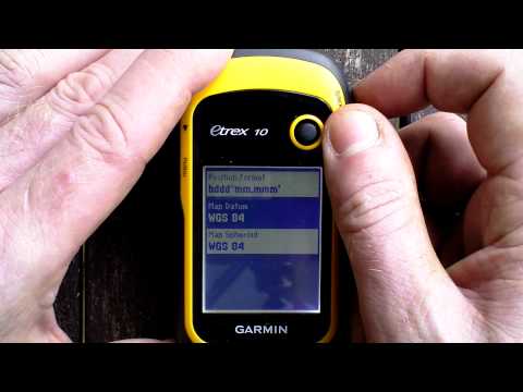
This short video has been created by GIS In Ecology to show you how you can quickly set up a GPS unit in such a way that the data you collect with it will be GIS-compatible. Mostly this is simply a matter of ensuring that you know what units things like the position are being recorded in and that the units you select are compatible with the GIS project the data are going to be used in. However, others like selecting the same datum as the projection/coordinate system of your GIS project are more critical.
You should check these settings each time you turn your GPS on, especially if someone else has used your GPS in the meantime as they may have changed some of the settings.
Similarly, if there are a number of you collecting data that is destined for a single GIS project with different GPS receivers, it is important to make sure that everyone has their unit set in the same way so that the data are as compatible as possible.
This short video has been created by GIS In Ecology to show you how you can quickly set up a GPS unit in such a way that the data you collect with it will be GIS-compatible. Mostly this is simply a matter of ensuring that you know what units things like the position are being recorded in and that the units you select are compatible with the GIS project the data are going to be used in. However, others like selecting the same datum as the projection/coordinate system of your GIS project are more critical.
You should check these settings each time you turn your GPS on, especially if someone else has used your GPS in the meantime as they may have changed some of the settings.
Similarly, if there are a number of you collecting data that is destined for a single GIS project with different GPS receivers, it is important to make sure that everyone has their unit set in the same way so that the data are as compatible as possible.
About this tutorial
GIS In Ecology published this 6:06 video tutorial on November 10, 2012. It has been watched 14,820 times on YouTube.
- Channel
- GIS In Ecology
- Category
- Education
- Duration
- 6:06
- Published
- November 10, 2012
- Views
- 14,820
- Likes
- 69
Tags
Share
This tutorial in other languages
- FRComment faire pour configurer un récepteur GPS SIG Collect des données compatibles
- ESCómo configurar un receptor GPS Para recoger datos GIS compatible
- PTComo configurar um receptor GPS Para GIS coletar dados Compatível
- ITCome impostare un ricevitore GPS per GIS raccogliere i dati Compatibile
- DEWie Einrichten von A-GPS-Empfänger in GIS Collect Kompatible Daten
- NLHoe het opzetten van een GPS-ontvanger GIS Collect compatibele gegevens
- RUКак настроить GPS приемник для сбора ГИС данных с поддержкой
- PLJak skonfigurować odbiornik GPS do zbierania danych GIS Compatible
- JAどのようにセットすると最大A GPS受信機に収集GIS互換性のあるデータ
- ARكيفية إعداد جهاز استقبال لنظم المعلومات الجغرافية اجمع متوافق البيانات
- HIकैसे करने के लिए सेट अप एक जीपीएस रिसीवर इकट्ठा जीआईएस संगत डाटा
- IDCara Set Up A GPS Receiver Untuk Kumpulkan GIS Kompatibel data