Playback starts YouTube’s embedded player (privacy-enhanced mode).
How to measure distance on Google Maps
ChannelHow-To GuideDescription from the creator
To Know how to measure distance on Google Maps watch the easy steps shown in this video tutorial .
Apart from the navigation in Google Maps, you can also measure the specific distance between two or more points to plan better your trip. Let’s know how we can use this great tool.
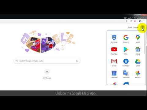
1. On the Google page, click on the Google Apps icon.
2. Click on the Google Maps App.
3. Right click on your starting point and click on Measure distance.
4. Now, click on your target destination location. This will create a path to measure distance.
5. If you want to measure more locations then click anywhere and this will create another point with a path.
6. You can drag the point to change your location for the measurement.
7. To remove the extra point from the map, click again on the point.
8. At bottom of the browser, you can see the Measure details of the total distance.
9. Click on cross sign to close the card.
Content in this video is provided on an "as is" basis with no express or implied warranties whatsoever. Any reference of any third party logos, brand names, trademarks, services marks, trade names, trade dress and copyrights shall not imply any affiliation to such third parties, unless expressly specified
Apart from the navigation in Google Maps, you can also measure the specific distance between two or more points to plan better your trip. Let’s know how we can use this great tool.
1. On the Google page, click on the Google Apps icon.
2. Click on the Google Maps App.
3. Right click on your starting point and click on Measure distance.
4. Now, click on your target destination location. This will create a path to measure distance.
5. If you want to measure more locations then click anywhere and this will create another point with a path.
6. You can drag the point to change your location for the measurement.
7. To remove the extra point from the map, click again on the point.
8. At bottom of the browser, you can see the Measure details of the total distance.
9. Click on cross sign to close the card.
Content in this video is provided on an "as is" basis with no express or implied warranties whatsoever. Any reference of any third party logos, brand names, trademarks, services marks, trade names, trade dress and copyrights shall not imply any affiliation to such third parties, unless expressly specified
About this tutorial
How-To Guide published this 1:10 video tutorial on April 6, 2020. It has been watched 5,215 times on YouTube.
- Channel
- How-To Guide
- Category
- Science & Technology
- Duration
- 1:10
- Published
- April 6, 2020
- Views
- 5,215
- Likes
- 17
Tags
Share
This tutorial in other languages
- FRComment mesurer la distance sur Google Maps
- ES¿Cómo se mide la distancia en Google Maps
- PTComo medir a distância no Google Maps
- ITCome misurare la distanza su Google Maps
- DEWie man misst Abstand auf Google Maps
- NLHoe kan ik afstand op Google Maps te meten
- RUКак измерить расстояние на Google Maps
- PLJak zmierzyć odległość na Google Maps
- JAGoogleマップ上の距離を測定する方法
- ARكيفية قياس المسافة على خرائط جوجل
- HIगूगल मैप्स पर दूरी को मापने के लिए
- IDBagaimana mengukur jarak di Google Maps